
They make it easier to understand how the war spread across Europe, Africa, Asia, and the oceans. By looking at a World War II map, anyone can follow how armies moved, which places were taken over or freed, and how big decisions changed the course of history in one of the world’s most important and far-reaching wars.
Free World War 2 Map

Printable World War 2 Map – Worksheet

A worksheet is a valuable educational resource designed to help students and enthusiasts learn about the global events of World War II. This worksheet usually consists of a label or vacant map highlighting regional changes during main countries, coalitions, war places, and conflicts.

The learners can use it to detect the movements of affiliated and axis forces, identify major invasions, and understand how the war has changed the boundaries. By actively labeling, coloring, or answering questions on the worksheet, users achieve a clear understanding of the complex geography of World War 2 and its worldwide impact on nations and regions.
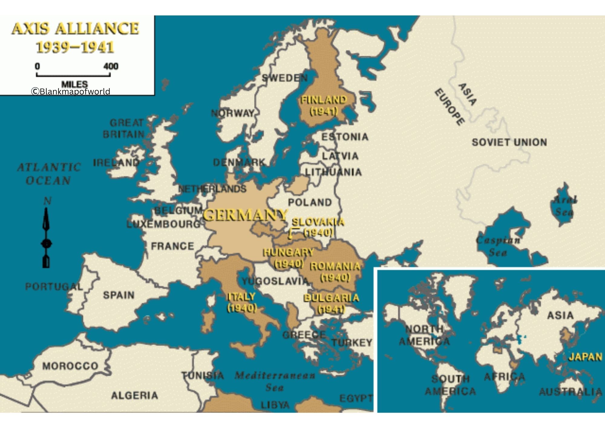
| Country | Alliance | 1939 Population (approx.) | 1939 Area (approx.) km² |
|---|---|---|---|
| Germany | Axis | 69 million | 633,786 km² |
| Italy | Axis | 44 million | 301,340 km² |
| Japan | Axis | 71 million | 377,915 km² |
| Soviet Union | Allies | 170 million | 22,400,000 km² |
| United Kingdom | Allies | 47 million | 243,610 km² (plus colonies) |
| United States | Allies | 131 million | 9,826,675 km² |
| France | Allies | 42 million | 551,695 km² |
| China | Allies | 412 million | 9,596,961 km² |
| Poland | Allies | 35 million | 388,634 km² |
| Canada | Allies | 11 million | 9,984,670 km² |
| Australia | Allies | 7 million | 7,692,024 km² |
| New Zealand | Allies | 1.6 million | 268,838 km² |
| Finland | Axis co-belligerent | 3.7 million | 337,000 km² |
| Hungary | Axis | 9 million | 93,028 km² |
| Romania | Axis (until 1944) | 20 million | 295,000 km² |
| Yugoslavia | Allies | 15 million | 255,804 km² |
| Greece | Allies | 7 million | 131,957 km² |
| Philippines | Allies | 16 million | 300,000 km² |
World War 2 Map – Outline

The map of World War 2 provides a simplified, label-free view of countries and regions involved in World War II. This type of map focuses on showing boundaries and landmasses during wartime, without names, and helps students and historians to mark the movements of major warplaces, coalition contingents.

It provides a vacant canvas to find out how political boundaries were moved before and after the war, making it an excellent resource for lessons, research projects, or interactive activities. With the Map outline, you can detect military campaigns, identify the axis and affiliated areas, and better understand this important period in world history.