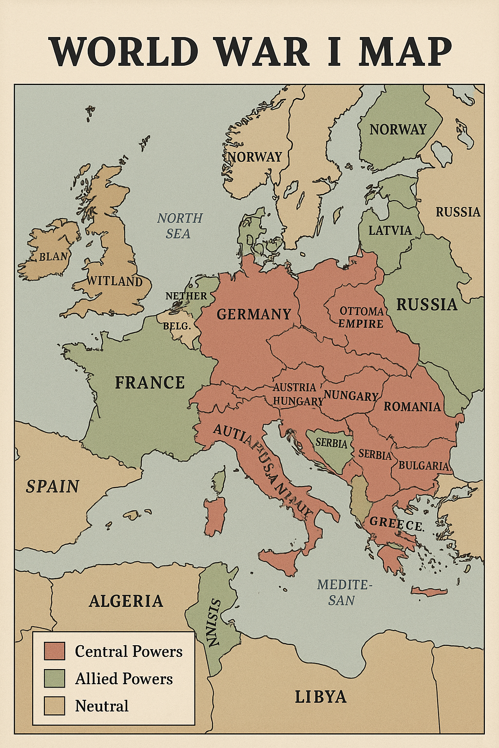
A World War I Map provides a powerful visual representation of political and military scenarios during one of the most destructive global conflicts in history, which occurred from 1914 to 1918. These maps usually show complex alliances, regional businesses, and front lines that define the war in Europe, the Middle East, Africa, and beyond. They highlight central powers under the leadership of Germany, Austria-Hungary, and the Ottoman Empire, and their opponents in the allied powers, Britain, France, Russia, and later in the United States.
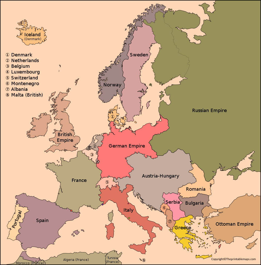
The trenches, war zones, and neutral countries have been marked, knowing how the war has been replaced by political boundaries and societies. Such maps are valuable educational equipment, which help students and historians understand the sheer scale of troop movements, strategic objectives, and destruction. By studying the map of the First World War, viewers receive a deep appreciation of geopolitical stresses, alliances, and consequences shaping the modern world after the end of the war.
Printable World War 1 Map
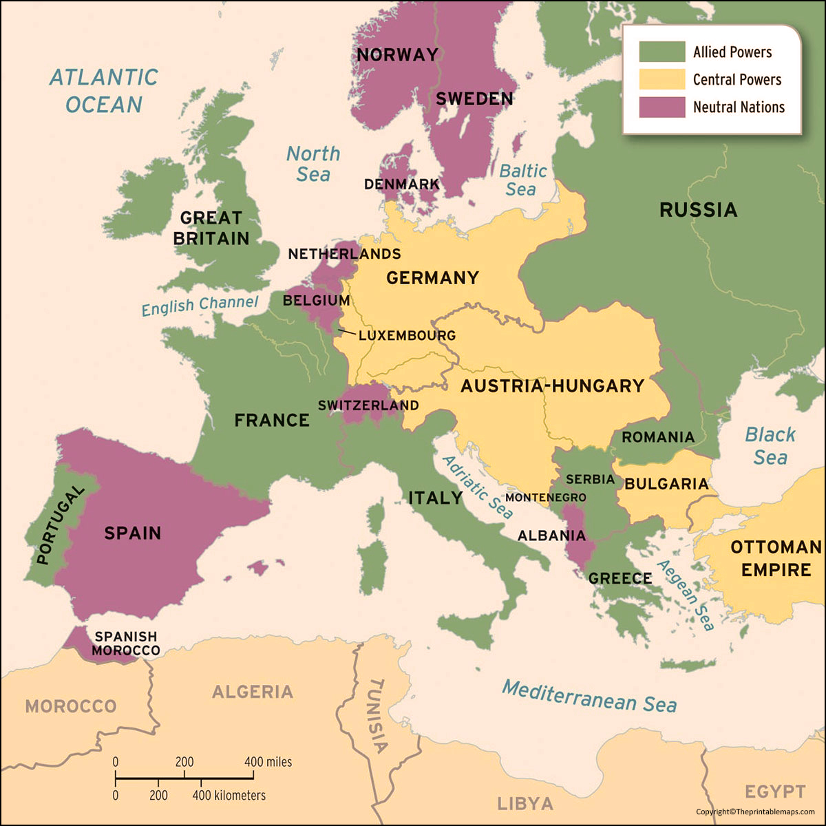
The Printable World War 1 Map is a straightforward image of the planet when the First World War (1914- 1918) was ruling the world. It indicates which nations were at war with one another, which ones were allied with one another, and where the major confrontations occurred.
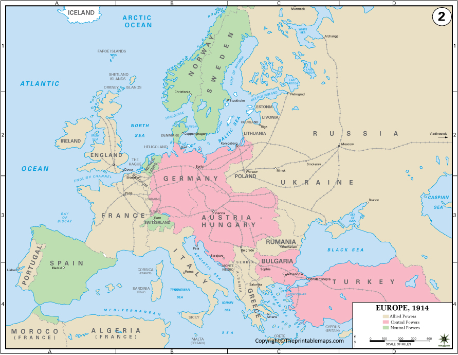
The map indicates significant regions such as the Western Front, the Eastern Front, and other front lines. You get to see as well how the boundaries of countries were then. Such a type of map is convenient to students, teachers, or anybody interested in history. Because it is printable, you can have a copy to use either in school, learning at home, or simply to learn about the war more simply.
| Country | Population (approx, 1914) | Area (km², approx) | Capital |
|---|---|---|---|
| United Kingdom | 45 million | 243,000 | London |
| France | 40 million | 551,000 | Paris |
| Germany | 68 million | 541,000 | Berlin |
| Austria-Hungary | 52 million | 676,000 | Vienna (Austria) |
| Russia | 170 million | 22,400,000 | St. Petersburg |
| Italy | 35 million | 301,000 | Rome |
| Ottoman Empire | 24 million | 1,800,000 | Constantinople |
| United States | 98 million | 9,630,000 | Washington, D.C. |
| Serbia | 4.5 million | 88,000 | Belgrade |
| Belgium | 7.5 million | 30,500 | Brussels |
| Bulgaria | 4.9 million | 111,000 | Sofia |
| Romania | 7.5 million | 138,000 | Bucharest |
| Japan | 52 million | 378,000 | Tokyo |
| Portugal | 6 million | 92,000 | Lisbon |
| Greece | 5 million | 131,000 | Athens |
| Montenegro | 0.3 million | 13,800 | Cetinje |
World War 1 Map – Outline
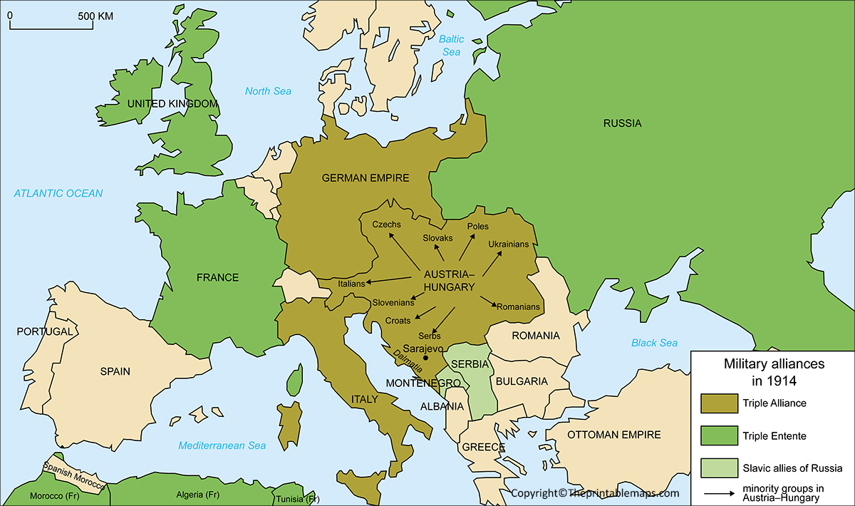
A World War 1 map, the outline provides a simplified, unconcerned illustration of the front lines included in the major regions, countries, and World War I, without labels or wide marks. It usually highlights the borders of European countries as they stood from 1914 to 1918, including alliances like friendly countries and the Central Powers.
This blank outline map is useful for educational activities, helps students detect fighting, contingent movements, and shifting boundaries. Historians and researchers can use it to explain how dramatically the political boundaries of Europe have changed after the war. Its clean, flexible design makes it an ideal basis for interactive learning and analysis.
![Blank Map of World [Free Printable Maps]](https://blankmapofworld.com/wp-content/uploads/2025/05/blank-map-logo-1.png)